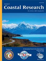
Peak of Aoraki/Mount Cook in the Southern Alps mountain range, New Zealand.
Aoraki/Mount Cook is the highest mountain in New Zealand. Its height since 2014 is listed as 3724 m, down from 3764 m before December 1991, due to a rockslide and subsequent erosion. It lies in the Southern Alps, a mountain range which runs the length of the South Island, with the foothills forming the coast to several proglacial lakes, which include Lake Pukaki, Lake Tekapo, Lake Ohau, and Tasman Lake. A popular tourist destination, it is also a favorite challenge for mountain climbers. The summits lie slightly south and east of the main divide of the Southern Alps, with the Tasman Glacier to the east and the Hooker Glacier to the west. The Southern Alps were formed by tectonic uplifting and pressure as the Pacific and Indo-Australian Plates collided along the South Island's western coast. The uplifting continues, raising Aoraki/Mount Cook an average of 7 mm each year. However, erosive forces are also powerful shapers of the mountains. The severe weather is due to the mountain's jutting into powerful westerly winds of the Roaring Forties, which run at approximately 45° S latitude, south of both Africa and Australia. In fact, the Southern Alps are the first obstacle the winds encounter after South Africa and Australia, having moved east across the Southern Ocean. (Photograph taken 20 January 2016 by Dr. Jooyong Lee, Sungkyunkwan University [SKKU], Suwon, Republic of Korea.)


